How Drones Help Keep Construction Projects On Schedule and Under Budget

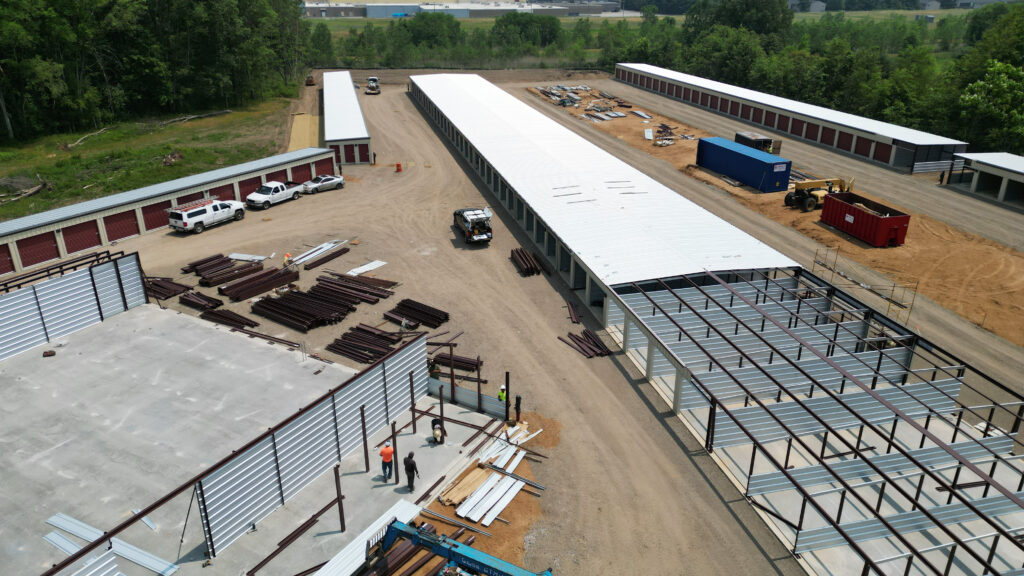
Drones offer a unique view of construction, helping ensure timelines are met and resources are optimized.

How Drones Help Keep Construction Projects On Schedule and Under Budget

In the construction industry, staying on schedule and within budget is critical for project success. Delays and unexpected expenses can disrupt timelines, escalate costs, and even harm a construction company’s reputation. In recent years, drones have emerged as a powerful tool to combat these challenges, providing new ways to monitor progress, manage risks, and optimize resources. Here’s how drones can help construction projects stay on track and minimize costs through regular progress monitoring and advanced data collection.


1. Real-Time Progress Monitoring for Better Project Management

Drones allow construction teams to monitor a project’s progress in real-time by capturing detailed aerial images and videos of the entire site. This constant monitoring helps project managers stay informed on each stage of development, allowing them to compare actual progress with the planned timeline.

If a part of the project is falling behind, drones can quickly capture the issue, enabling managers to address it before it escalates into a costly delay. For example, if certain materials or equipment are missing or improperly placed, drone footage can help identify these issues right away, leading to quick corrective actions. By keeping an eye on the project’s status with real-time data, drones can prevent costly overruns and help meet deadlines.


2. Faster and More Accurate Site Inspections

Traditional site inspections require a significant amount of time and effort, often involving multiple workers and various tools to monitor construction progress. With drones, inspections can be conducted quickly and accurately from the air, capturing a complete view of the site in a fraction of the time. This allows for more frequent inspections without disrupting the work on the ground.

Drones can reach hard-to-access areas and provide a top-down view that offers valuable insights into site layout and structure. By speeding up inspections and ensuring accuracy, drones help project managers identify potential issues early, preventing future delays and keeping the project on track.


3. Reducing Costs Through Efficient Resource Allocation

Construction projects can be expensive, especially if resources are not allocated properly. By using drones to monitor and document resource use, managers can optimize how materials, labor, and equipment are allocated across the site.

For example, drones can be used to track stockpiles of materials, check inventory levels, and identify where equipment is being underutilized or misplaced. This aerial perspective can help managers make data-driven decisions that reduce waste and optimize resources. When resources are managed efficiently, overall costs decrease, keeping the project within budget.


4. Minimizing Risks and Enhancing Site Safety

Construction sites are inherently risky, and accidents can lead to delays and added costs. Drones provide a safer alternative for site inspections, particularly in hazardous or hard-to-reach areas. Rather than sending workers into potentially dangerous situations, drones can be used to monitor high-risk areas from a safe distance.

Additionally, drones can provide a broader view of the site to help identify potential safety risks. For example, they can detect areas with improper fencing, weak structural points, or overcrowded zones that might pose a danger to workers. By improving safety measures, drones help prevent accidents, minimize delays due to injuries, and ultimately save on unexpected costs associated with site safety issues.


5. Enhanced Communication with Stakeholders

Clear communication with stakeholders, such as clients and investors, is essential for keeping a project on track. Drones offer an effective way to keep everyone informed with visual updates that show exactly what’s happening on the ground. Regular aerial footage of the site can be shared with stakeholders to provide a clear picture of project progress without needing them to visit the location.

Visual updates help stakeholders stay engaged and informed, reducing the likelihood of miscommunication or misunderstandings. It also builds confidence and trust in the project, especially if it’s on schedule and within budget. Transparent communication enabled by drone footage can lead to smoother decision-making and less resistance to budget changes or adjustments.


6. Improved Project Documentation and Record-Keeping

Documentation is essential in construction, especially when it comes to tracking project changes, addressing potential disputes, or creating a record of completed work. Drones provide a reliable way to document the project’s progress from start to finish, creating a visual record of each stage.

This comprehensive documentation can be invaluable if disputes arise or if the client has concerns about the timeline or costs. With detailed aerial footage, project managers have an unbiased record that shows the state of the project at any given point in time. This record can also help with future projects by providing insights into best practices and common challenges.


7. Precision and Accuracy in Mapping and Surveying

For large construction projects, accurate mapping and surveying are critical for ensuring that the work is completed as planned. Drones equipped with advanced sensors and GPS technology can create precise 3D maps and topographical surveys. These maps provide accurate measurements, which can be compared to design plans to ensure that everything is on track.

Traditional surveying can be time-consuming and expensive, but drones streamline this process by capturing high-quality data quickly and efficiently. Improved accuracy helps prevent costly rework, saving time and money on materials and labor, and contributes to a more predictable project timeline.


8. Post-Project Analysis and Continuous Improvement

Once a project is completed, drone footage can be used for post-project analysis to review what worked well and what could have been improved. This data can help construction companies refine their processes for future projects, identifying potential efficiencies and areas for cost reduction.

For example, reviewing drone footage might reveal that certain phases of the project were completed faster than others, or that some resources were underutilized. By understanding these patterns, companies can continuously improve their project management strategies, leading to even better time and cost savings in the future.


Conclusion

Drones have revolutionized the construction industry, providing an innovative way to keep projects on schedule and within budget. From real-time monitoring and accurate inspections to improved safety and enhanced communication, drones offer a comprehensive solution to many of the challenges that construction teams face.

By integrating drone technology into their workflows, construction companies can streamline their processes, make better-informed decisions, and minimize the risk of costly delays and overruns. At Bender Drone Services, we’re committed to helping construction teams harness the power of drones to deliver projects efficiently and cost-effectively. Contact us today to learn more about how drone technology can benefit your next construction project.
The Importance of Insurance in the Commercial Drone Industry

Drone insurance ensures that every flight, like this one, is covered from takeoff to landing.

The commercial use of drones has expanded across numerous industries, from real estate and construction to agriculture and entertainment. As the applications of drones continue to grow, so do the associated risks and liabilities. At Bender Drone Services, we understand the critical importance of comprehensive insurance for drone operators and businesses leveraging drone technology. In this blog post, we’ll explore why having robust insurance coverage is essential for protecting your operations and investments.

Protecting Against Liability

One of the primary reasons for obtaining insurance is to safeguard against liability. Drone operations inherently involve risks, such as property damage, personal injury, or invasion of privacy. Even with the most skilled pilots and advanced technology, accidents can happen. Liability insurance provides coverage for legal claims and potential lawsuits arising from such incidents, protecting drone operators and businesses from significant financial burdens.

Covering Damage to Drones and Equipment

Drones are valuable assets, and any damage to them can result in costly repairs or replacements. Comprehensive insurance policies often include coverage for hull damage, which protects the physical components of the drone. This coverage extends to incidents like crashes, collisions, or technical malfunctions. By having insurance, operators can ensure that their investment in drone technology is safeguarded, allowing them to continue their operations without undue financial strain.

Ensuring Compliance with Regulations

As the commercial drone industry is subject to stringent regulations, many governing bodies mandate that drone operators carry adequate insurance. For example, the Federal Aviation Administration (FAA) in the United States requires commercial drone operators to have liability insurance as part of their operational guidelines. By obtaining the necessary insurance coverage, businesses can ensure compliance with these regulations, avoiding penalties and maintaining their licenses to operate.

Enhancing Credibility and Trust

Having comprehensive insurance coverage enhances the credibility and trustworthiness of drone operators and businesses. Clients and partners are more likely to work with insured operators, knowing that any potential risks are covered. This not only helps in building a positive reputation but also opens up more business opportunities. Insurance acts as a testament to a company’s commitment to safety and professionalism.

Mitigating Operational Risks

Drone operations often involve navigating complex environments and weather conditions, which can pose significant risks. Insurance provides a safety net that allows operators to undertake their missions with confidence. Whether it’s conducting aerial surveys in challenging terrains or capturing footage in unpredictable weather, knowing that they are insured enables operators to focus on delivering quality services without constantly worrying about potential mishaps.

Facilitating Business Expansion

As businesses look to expand their drone operations into new markets and applications, insurance becomes even more critical. Different industries have varying risk profiles, and having appropriate insurance coverage allows businesses to explore these opportunities without hesitation. For instance, a construction company using drones for site inspections or a real estate firm leveraging aerial photography can confidently pursue these ventures, knowing that their insurance covers any unforeseen incidents.

Supporting Long-Term Sustainability

In the long run, comprehensive insurance contributes to the sustainability of drone businesses. By protecting against financial losses, legal liabilities, and operational disruptions, insurance helps ensure that companies can continue to operate and grow. This sustainability is vital for maintaining a competitive edge in the dynamic drone industry.

Conclusion

The commercial drone industry holds immense potential, but with it comes a host of risks and liabilities. Comprehensive insurance is not just a regulatory requirement; it is a crucial safeguard that protects drone operators and businesses from financial losses, legal challenges, and reputational damage. At Bender Drone Services, we advocate for the importance of insurance in ensuring safe, compliant, and sustainable drone operations. By investing in the right insurance coverage, businesses can confidently harness the power of drone technology and unlock its full potential in various sectors.

The Benefits of Aerial Photography for Marketing and Advertising

Highlighting the beauty and scale of properties and events with the power of aerial photography for compelling marketing content.

In the digital age, where visual content reigns supreme, businesses are constantly seeking innovative ways to capture attention and differentiate themselves from the competition. Aerial photography has emerged as a powerful tool in this quest, offering unique perspectives that traditional ground-based photography simply cannot match. At Bender Drone Services, we understand the transformative impact that aerial photography can have on your marketing and advertising efforts. In this blog post, we’ll explore the myriad of benefits of incorporating aerial imagery into your marketing strategy and how it can help your business stand out.


Unique and Engaging Visual Content

Aerial photography provides a bird’s-eye view that is not only visually stunning but also offers a fresh perspective that can captivate audiences. This unique vantage point allows you to showcase your business, property, or event in ways that are both dynamic and engaging. Whether it’s a sweeping view of your corporate campus, an expansive shot of a new development project, or an immersive look at a bustling event, aerial images can make your marketing materials more compelling and memorable.

Enhanced Social Media Presence

In the world of social media, eye-catching visuals are key to grabbing attention and driving engagement. Aerial photos and videos stand out in the crowded social media landscape, attracting likes, shares, and comments. By incorporating aerial imagery into your social media posts, you can create content that resonates with your audience and encourages interaction. High-quality aerial shots can also help you build a more polished and professional online presence, boosting your brand’s credibility and appeal.

Highlighting Key Features and Amenities

Aerial photography is particularly effective for highlighting the unique features and amenities of a property or location. For real estate agents, this means being able to showcase properties in their entirety, including landscapes, proximity to key amenities, and overall layout. For businesses, it provides an opportunity to highlight the size, scale, and setting of their operations. This comprehensive view can help potential customers or clients get a better sense of what you have to offer, ultimately driving interest and sales.

Differentiating Your Brand

In competitive markets, finding ways to differentiate your brand is crucial. Aerial photography allows you to present your business in a way that is distinctive and innovative. By using drone-captured images, you can create marketing materials that stand out from the generic, run-of-the-mill content that many businesses rely on. This unique approach not only helps you attract attention but also positions your brand as forward-thinking and dynamic.

Versatility Across Marketing Channels

The versatility of aerial photography makes it an excellent asset for a wide range of marketing channels. From your website and social media to brochures, presentations, and advertisements, aerial images can be seamlessly integrated into various formats to enhance your marketing campaigns. Whether you are looking to create a stunning homepage banner, an engaging social media post, or a captivating promotional video, aerial photography provides the visual impact you need to elevate your content.

Cost-Effective and Efficient

While aerial photography may seem like a significant investment, it can actually be a cost-effective solution when you consider the breadth and quality of the content it provides. With drones, you can capture a large number of high-quality images in a relatively short amount of time, reducing the need for multiple ground-based photoshoots. This efficiency not only saves you time but also helps you manage marketing budgets more effectively.


Aerial photography is a game-changer for businesses looking to create compelling marketing materials and build a strong, visually appealing brand presence. By leveraging the unique perspectives and versatility of aerial imagery, you can enhance your marketing efforts, engage your audience, and set your business apart from the competition. At Bender Drone Services, we specialize in delivering stunning aerial photography that can help you achieve these goals and more. Contact us today to learn how we can elevate your marketing strategy with our professional drone services.

The Transformative Power of Drone Technology in Planning

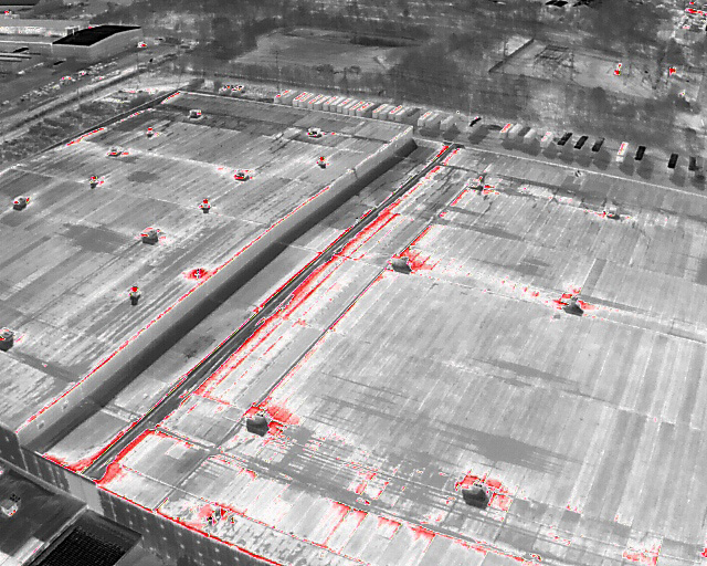
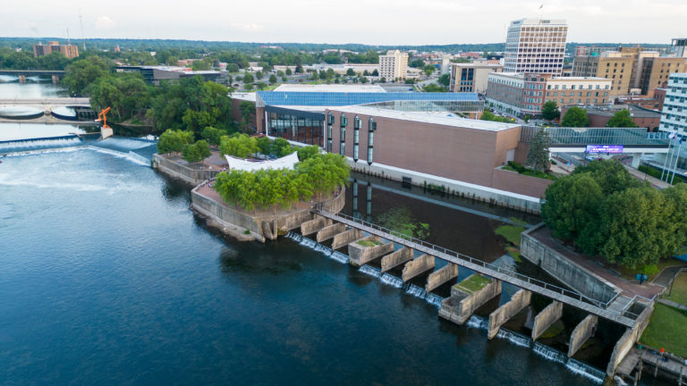
Drone mapping provides invaluable insights for urban planners and developers.

In today’s rapidly evolving landscape of urban development and infrastructure planning, the utilization of cutting-edge technology has become paramount to ensure efficiency, accuracy, and cost-effectiveness. One such technology that has revolutionized the field is drone mapping. At Bender Drone Services, we recognize the indispensable role that drone mapping plays in shaping the future of planning and infrastructure projects.

Drone mapping, also known as aerial surveying or photogrammetry, involves capturing high-resolution aerial imagery of landscapes and structures using unmanned aerial vehicles (UAVs) equipped with specialized cameras and sensors. These images are then processed using sophisticated software to create detailed maps, 3D models, and geospatial data that provide valuable insights for planners, engineers, and developers.

One of the primary benefits of drone mapping is its ability to rapidly collect vast amounts of data over large areas with unparalleled precision and accuracy. Traditional surveying methods often require extensive time and resources, whereas drones can efficiently cover expansive territories in a fraction of the time, minimizing project timelines and costs.

Moreover, drone mapping offers a level of detail and perspective that is unmatched by ground-based surveys. By capturing aerial imagery from different angles and elevations, drones can provide comprehensive views of landscapes, structures, and infrastructure, enabling stakeholders to make informed decisions throughout the planning and design process.

In urban planning and development projects, drone mapping plays a crucial role in site analysis, land use planning, and environmental assessment. By generating detailed topographic maps and 3D models, planners can evaluate terrain features, identify potential constraints, and optimize land utilization strategies. Additionally, drone mapping facilitates the identification of environmental factors such as vegetation cover, water bodies, and ecological habitats, aiding in the preservation of natural resources and ecosystems.

Furthermore, in infrastructure projects such as road construction, utility installations, and transportation planning, drone mapping offers invaluable insights into existing conditions and potential challenges. By conducting aerial surveys of project sites, engineers can assess terrain characteristics, identify optimal routes, and detect obstacles or hazards that may impact construction activities.

At Bender Drone Services, we are committed to leveraging the power of drone mapping to support planning and infrastructure projects across various sectors. Our team of experienced drone pilots and mapping specialists utilizes state-of-the-art UAV technology and advanced software solutions to deliver accurate, actionable data that drives project success.

In conclusion, the role of drone mapping in planning and infrastructure projects cannot be overstated. By harnessing the capabilities of drone technology, stakeholders can streamline project workflows, mitigate risks, and achieve better outcomes in the built environment. As we continue to innovate and push the boundaries of what is possible, Bender Drone Services remains at the forefront of delivering reliable and cost-effective drone mapping solutions for the future of planning and development.

Ensuring Safety: A Fundamental Aspect of Drone Operations

In the drone industry, safety is non-negotiable. We prioritize it every step of the way.

Flying drones requires more than just technical know-how; it demands a deep commitment to safety. At Bender Drone Services, we prioritize safety above all else in every flight we undertake. In this blog post, we’ll delve into the importance of safety when operating drones and outline the steps that every drone pilot should take to ensure a safe flight.

Safety is paramount in drone operations, not only to protect the drone and equipment but also to safeguard people, property, and airspace. One of the fundamental steps to ensure safety is to conduct a thorough pre-flight inspection of the drone and equipment. This includes checking for any signs of damage or malfunction, ensuring all components are securely attached, and verifying that the batteries are fully charged.

Before taking off, drone pilots should also assess the surrounding environment for any potential hazards or obstacles that could pose a risk during flight. This includes checking for nearby buildings, power lines, trees, or other structures that could interfere with the drone’s flight path.

Once in the air, maintaining situational awareness is crucial. Drone pilots should constantly monitor the drone’s position, altitude, and orientation to ensure it stays within the designated flight area and avoids any potential collisions or hazards. Additionally, staying informed about weather conditions and airspace restrictions is essential to mitigate risks and ensure a safe flight.

In the event of an emergency or unexpected situation, drone pilots should be prepared to take swift and decisive action to prevent accidents or injuries. This may include executing an emergency landing, activating the return-to-home function, or manually controlling the drone to a safe landing spot.

At Bender Drone Services, safety is ingrained in everything we do. From rigorous training and certification programs for our pilots to strict adherence to regulatory guidelines and best practices, we take every precaution to ensure the safety of our operations. By prioritizing safety at all times, we can deliver reliable and responsible drone services while minimizing risks to people and property.

Prioritizing Safety: Guidelines for Drone Pilots Near South Bend International Airport

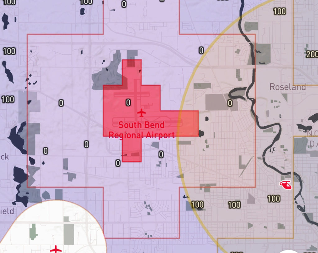
Any drone flight near the South Bend International airport must receive authorization.

In the ever-increasing landscape of drone use, safety remains paramount for all drone operators. At Bender Drone Services, we recognize the importance of adhering to regulations and prioritizing aviation safety in all our operations. In this blog post, we delve into the essential guidelines for flying drones near airports, with a specific focus on our local airport, South Bend International Airport (SBN).

Controlled airspace is divided into various classes- Class B, C, D, and E airspace, each with distinct regulations governing drone operations. Class B airspace surrounds the Untied States’ largest airports, such as O’Hare International Airport (ORD) in Chicago. Regional or mid-sized airports fall under Class C airspace, which includes the South Bend International Airport. Smaller regional airports, such as Kalamazoo/Battle Creek International Airport (AZO) or Fort Wayne International Airport (FWA), are classified as Class D airspace.

Knowing the classification of each airport aids in understanding the laws and regulations for flying a drone near that airport. For the South Bend International, the airspace extends from the surface to a specified altitude around and above the airport. Within this airspace, communication with Air Traffic Control (ATC) is mandatory, and drone flights require prior authorization.

For any drone flight within five miles of South Bend International Airport, obtaining authorization is imperative. This ensures coordination with manned aircraft operations and helps prevent airspace conflicts. Additionally, drone pilots must adhere to altitude restrictions, with flights above 400 feet above ground level requiring authorization through the Low Altitude Authorization and Notification Capability (LAANC) system.

At Bender Drone Services, we are committed to upholding the highest standards of safety and professionalism in all our drone operations. By adhering to regulations and prioritizing aviation safety, we aim to provide our clients with reliable and responsible drone services while ensuring the safety of airspace users.

Elevating Business Visibility: The Power of Aerial Photography for Commercial Properties

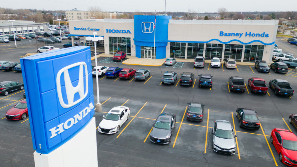
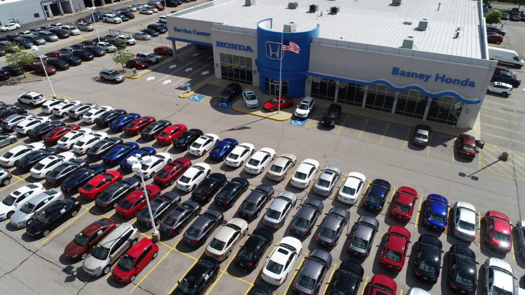
Our aerial photography unveils the full potential of properties, showcasing unique features and maximizing visibility.

In the fast-paced world of commercial real estate, the need to stand out in a crowded market is paramount. Traditional methods of showcasing properties through ground-level photography can only convey so much. Enter the era of aerial photography – a game-changer that offers a bird’s-eye view of commercial properties, providing a perspective that was once exclusive to larger budgets. In this blog post, we’ll explore the transformative impact of aerial photography on enhancing the visibility of commercial properties, with a focus on the specialized services offered by Bender Drone Services.

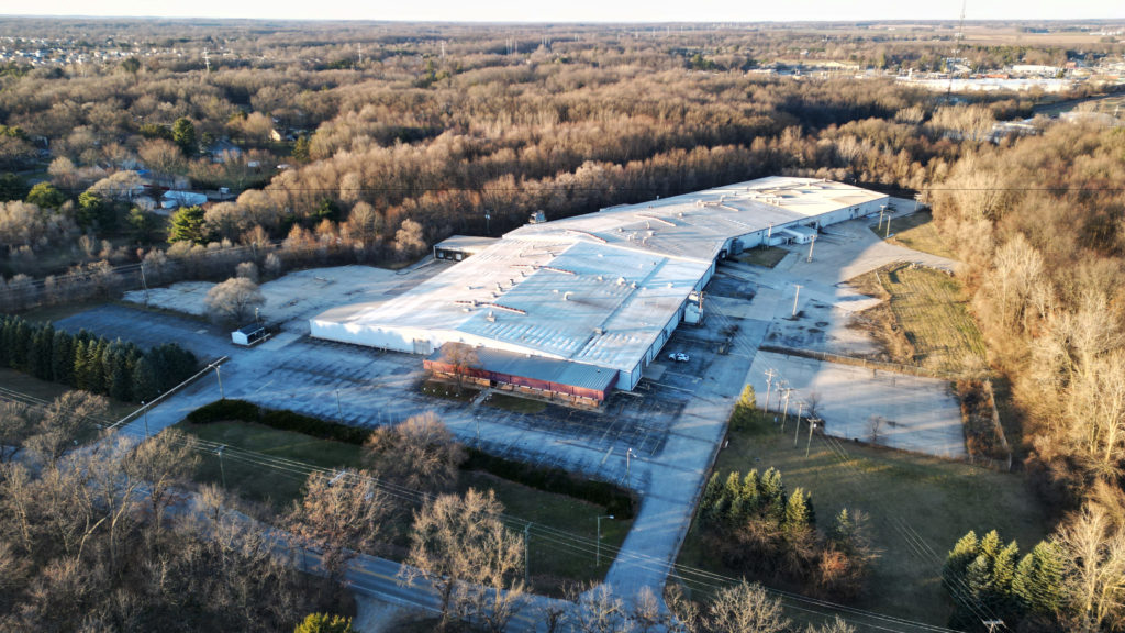
Aerial photography provides a unique vantage point that goes beyond what traditional ground-level photography can offer. It allows potential buyers and investors to gain a comprehensive understanding of the property’s layout, surrounding areas, and overall appeal. Bender Drone Services, a provider of aerial imaging since 2018, brings innovation to commercial property marketing. With state-of-the-art drones equipped with high-resolution cameras, they capture stunning aerial shots that highlight the distinctive features of commercial properties.

One of the significant advantages of aerial photography is its ability to capture the entirety of a property. Bender Drone Services ensures that clients get a holistic view, showcasing not just the building itself but also its surroundings, neighboring businesses, and accessibility. Every commercial property has unique selling points, whether it’s expansive outdoor spaces, convenient parking facilities, or proximity to key landmarks. Aerial photography effectively highlights these features, making them more appealing to potential buyers.

Aerial imagery also provides context to the property’s location. Bender Drone Services goes beyond just showcasing the property; they capture its relationship with nearby amenities, transportation networks, and other relevant features that can influence a buyer’s decision. Aerial photography has a higher visual impact compared to traditional photography. It captures attention and generates interest, increasing the likelihood of potential buyers exploring the commercial property further. For buyers, aerial photography offers the advantage of making informed decisions without physically visiting the site initially. It saves time and resources, allowing them to filter properties based on their specific requirements.

Bender Drone Services understands the unique needs of commercial real estate. Their aerial photography services are not just about capturing images; they are about crafting a narrative that resonates with the target audience and positions the commercial property for success in the market.

In conclusion, aerial photography has become an indispensable tool for commercial property marketing. Bender Drone Services, with their expertise and cutting-edge technology, ensures that commercial properties not only meet the eye but leave a lasting impression. Elevate your business visibility and soar above the competition with the transformative power of aerial photography.

How Aerial Photography Reshapes South Bend’s Real Estate Market

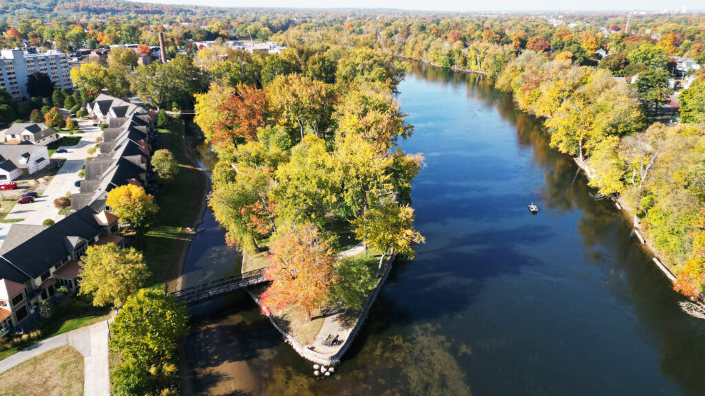
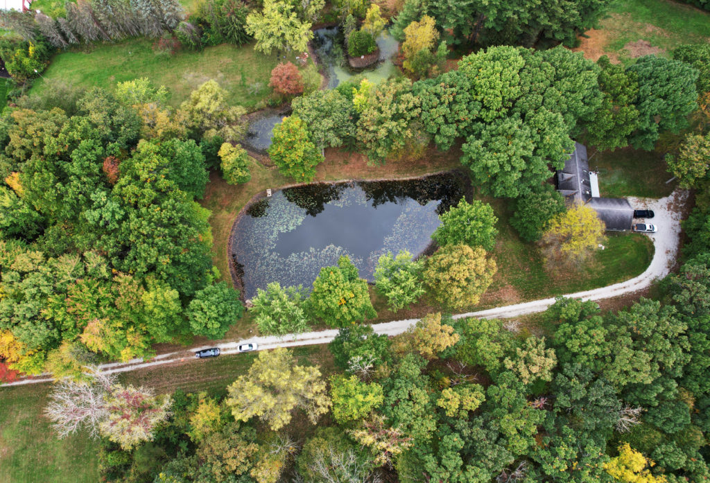
An advantage of aerial photography is the ability to capture the changing seasons.

In the ever-evolving realm of real estate marketing, aerial photography has emerged as a game-changer, providing a fresh and compelling perspective that goes beyond traditional listing imagery. Here in South Bend, Indiana area, the use of drone technology has redefined how we showcase properties, offering a unique glimpse into the art of aerial real estate photography.


Soaring Above: A New View of South Bend Homes


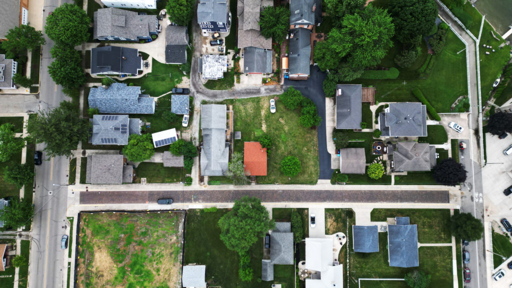
Traditionally, real estate listings rely on ground-level shots to depict a property’s features. However, with the advent of drone technology, we can now elevate the viewing experience. Aerial photography captures homes from above, providing potential buyers with a comprehensive understanding of the property’s layout, surroundings, and unique features.


Showcasing Neighborhoods: Beyond the Front Door


In a city as diverse and charming as South Bend, the surrounding neighborhood plays a crucial role in a property’s appeal. Aerial shots allow us to showcase not just the home but also the community it belongs to. Whether nestled in the historic districts, along the riverbanks, or amidst lush green suburbs, drone photography paints a vivid picture of the neighborhood’s character and amenities.


Highlighting Landscapes and Features


Aerial views are instrumental in highlighting a property’s outdoor features. From expansive lawns to swimming pools, and from rooftop decks to scenic views, drone photography captures these elements in a way that ground-level shots simply cannot. The result is a more comprehensive presentation that resonates with potential buyers.


Visualizing Space: A Bird’s-Eye Floor Plan


Understanding the spatial layout of a property is a crucial aspect of the home-buying process. Aerial shots provide a bird’s-eye view of the entire property, allowing prospective buyers to visualize the arrangement of rooms, gardens, and outdoor spaces in a way that traditional photography cannot convey.


Seasonal Flair: South Bend Through the Seasons


One of the unique advantages of aerial photography is the ability to capture the changing seasons. South Bend’s beauty transforms throughout the year, from snow-covered rooftops in winter to vibrant greenery in summer. Aerial shots document these seasonal shifts, adding a dynamic element to the presentation of real estate listings.


Safety and Efficiency: A Win-Win for Sellers and Buyers


Beyond aesthetics, the use of drone technology in real estate photography offers practical benefits. Drones provide a cost-effective and time-efficient way to capture high-quality images, reducing the time a property spends on the market. Additionally, they can access areas that may be challenging or unsafe for traditional photography methods.


In conclusion, the art of aerial real estate photography in South Bend is a testament to the marriage of technology and creativity. It enables us to present properties in a way that is both visually captivating and informatively rich. As the real estate landscape continues to evolve, embracing innovative approaches like drone photography ensures that South Bend’s homes are showcased with the distinction they deserve.

Elevating Construction Site Safety and Efficiency: The Role of Drone Inspections

In the dynamic realm of construction, innovation is key to improving safety, efficiency and project outcomes. One such groundbreaking technology making waves in the industry is drone technology. Unmanned Aerial Vehicles (UAVs) or drones have proven to be invaluable tools for construction site inspections, contributing significantly to enhanced safety protocols and streamlined operations.


A Bird’s-Eye Perspective: Enhancing Visibility and Safety

Traditional methods of site inspection often involve physical assessments or manned aerial surveys, both of which present inherent risks. Drones, equipped with high-resolution cameras and sensors, offer a safer alternative. By providing a bird’s-eye view of the construction site, drones allow for a comprehensive assessment without exposing personnel to potential hazards.


Efficient Site Surveys: Saving Time and Resources

Drone inspections significantly expedite the surveying process. In the past, conducting thorough site surveys required substantial time and resources. Drones, however, can cover large areas quickly, capturing detailed images and videos that aid in mapping, planning, and decision-making. This efficiency translates to time and cost savings throughout the project lifecycle.


Real-Time Monitoring: Proactive Issue Identification

Construction projects are dynamic, and issues can arise unexpectedly. Drones equipped with real-time monitoring capabilities enable project managers to identify and address potential problems promptly. From structural concerns to safety hazards, the ability to monitor the site in real time enhances the project’s overall resilience.


Accurate Data for Informed Decision-Making

The data collected by drones goes beyond mere visuals. Advanced sensors and cameras generate highly accurate and detailed information that can be used for precise measurements, volumetric analysis, and progress tracking. This accurate data empowers project managers and stakeholders to make informed decisions, minimizing errors and delays.


Enhanced Documentation: From Start to Finish

Documentation is a critical aspect of any construction project. Drones provide a systematic and detailed record of the construction site from its initial stages to completion. This documentation can be valuable for compliance, quality assurance, and future reference, fostering transparency and accountability.


Safety Compliance and Risk Mitigation

Drones contribute to safety compliance by allowing teams to monitor adherence to safety protocols and identify potential risks. This proactive approach to safety reduces the likelihood of accidents, enhances site security, and ensures that construction sites comply with industry regulations.


Conclusion: Pioneering Progress in Construction

Drone inspections are reshaping the landscape of construction site management, offering a potent blend of safety, efficiency, and technological advancement. As the construction industry continues to embrace innovation, the integration of drone technology is becoming a standard practice, setting new benchmarks for safety standards and project efficiency. Through aerial perspectives and cutting-edge data acquisition, drones are not just flying high; they are elevating the entire construction experience.

Elevating Success: The Benefits of Project Monitoring Through Aerial Photography

Aerial photography transforms project monitoring, providing valuable insights and elevating construction management.

In the fast-paced world of construction, real-time data and efficient decision-making are paramount to project success. Traditional methods of project monitoring often fall short, but with the advent of aerial photography, a revolutionary transformation has taken place. Here, we delve into the numerous advantages of utilizing aerial imagery for project monitoring, demonstrating how it can elevate your construction projects to new heights.

Unparalleled Perspective

Aerial photography provides an expansive view of the project site, offering a comprehensive perspective that ground-level photographs simply cannot match. With a bird’s-eye view, you gain insights into the entire project, including intricate details that might be missed otherwise. This perspective facilitates better project oversight, enabling you to spot potential issues and make informed decisions quickly.

Real-Time Progress Tracking

Aerial photography allows you to track project progress in real-time. Regularly scheduled drone flights capture up-to-date images of the site, creating a visual timeline of the project’s evolution. This real-time tracking is invaluable for identifying delays, deviations from the plan, or areas where additional resources are needed.

Enhanced Safety

Safety is a top priority in the construction industry. Drones provide a safer alternative to human inspectors, especially in hard-to-reach or hazardous areas of the site. By reducing the need for on-site inspections, you minimize the risk to your workforce and improve overall safety measures.

Improved Communication

Aerial imagery serves as a powerful communication tool. Share high-resolution images and videos with stakeholders, including clients, investors, and team members. These visuals offer a clear and easily digestible way to convey project status, making it easier for everyone involved to stay informed and aligned.

Cost Efficiency

Efficiency leads to cost savings. Aerial photography reduces the need for extensive on-site visits, saving both time and money. By identifying potential issues early, you can address them before they escalate into costly problems.

Data-Driven Decision-Making

Aerial imagery provides a wealth of data that goes beyond visual inspection. With the right software and analysis, you can extract valuable information about site conditions, progress rates, and resource allocation. This data-driven approach enhances decision-making, allowing you to optimize project management.

Documentation and Accountability

Having a visual record of the project’s progression is essential for documentation and accountability. Aerial imagery provides an unbiased, unambiguous record of the site’s condition at various stages, helping resolve disputes and ensuring compliance with project plans.

Marketing and Reporting

Aerial imagery isn’t just for internal use. It can be a powerful tool for marketing your projects. High-quality aerial photographs and videos showcase your work in a visually stunning way, helping attract new clients and investors.

In conclusion, aerial photography is revolutionizing project monitoring in the construction industry. Its ability to provide a unique, real-time perspective, enhance safety, and drive cost savings makes it an indispensable tool for modern construction projects. By incorporating aerial imagery into your project monitoring practices, you can elevate your projects to new heights of success.