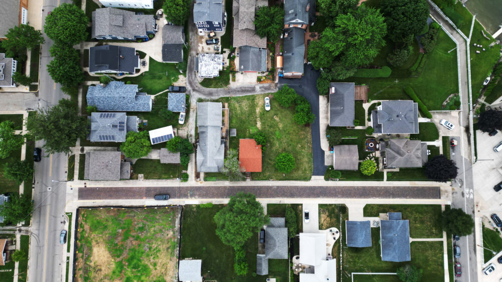
In today’s rapidly evolving landscape of urban development and infrastructure planning, the utilization of cutting-edge technology has become paramount to ensure efficiency, accuracy, and cost-effectiveness. One such technology that has revolutionized the field is drone mapping. At Bender Drone Services, we recognize the indispensable role that drone mapping plays in shaping the future of planning and infrastructure projects.
Drone mapping, also known as aerial surveying or photogrammetry, involves capturing high-resolution aerial imagery of landscapes and structures using unmanned aerial vehicles (UAVs) equipped with specialized cameras and sensors. These images are then processed using sophisticated software to create detailed maps, 3D models, and geospatial data that provide valuable insights for planners, engineers, and developers.
One of the primary benefits of drone mapping is its ability to rapidly collect vast amounts of data over large areas with unparalleled precision and accuracy. Traditional surveying methods often require extensive time and resources, whereas drones can efficiently cover expansive territories in a fraction of the time, minimizing project timelines and costs.
Moreover, drone mapping offers a level of detail and perspective that is unmatched by ground-based surveys. By capturing aerial imagery from different angles and elevations, drones can provide comprehensive views of landscapes, structures, and infrastructure, enabling stakeholders to make informed decisions throughout the planning and design process.
In urban planning and development projects, drone mapping plays a crucial role in site analysis, land use planning, and environmental assessment. By generating detailed topographic maps and 3D models, planners can evaluate terrain features, identify potential constraints, and optimize land utilization strategies. Additionally, drone mapping facilitates the identification of environmental factors such as vegetation cover, water bodies, and ecological habitats, aiding in the preservation of natural resources and ecosystems.
Furthermore, in infrastructure projects such as road construction, utility installations, and transportation planning, drone mapping offers invaluable insights into existing conditions and potential challenges. By conducting aerial surveys of project sites, engineers can assess terrain characteristics, identify optimal routes, and detect obstacles or hazards that may impact construction activities.
At Bender Drone Services, we are committed to leveraging the power of drone mapping to support planning and infrastructure projects across various sectors. Our team of experienced drone pilots and mapping specialists utilizes state-of-the-art UAV technology and advanced software solutions to deliver accurate, actionable data that drives project success.
In conclusion, the role of drone mapping in planning and infrastructure projects cannot be overstated. By harnessing the capabilities of drone technology, stakeholders can streamline project workflows, mitigate risks, and achieve better outcomes in the built environment. As we continue to innovate and push the boundaries of what is possible, Bender Drone Services remains at the forefront of delivering reliable and cost-effective drone mapping solutions for the future of planning and development.
