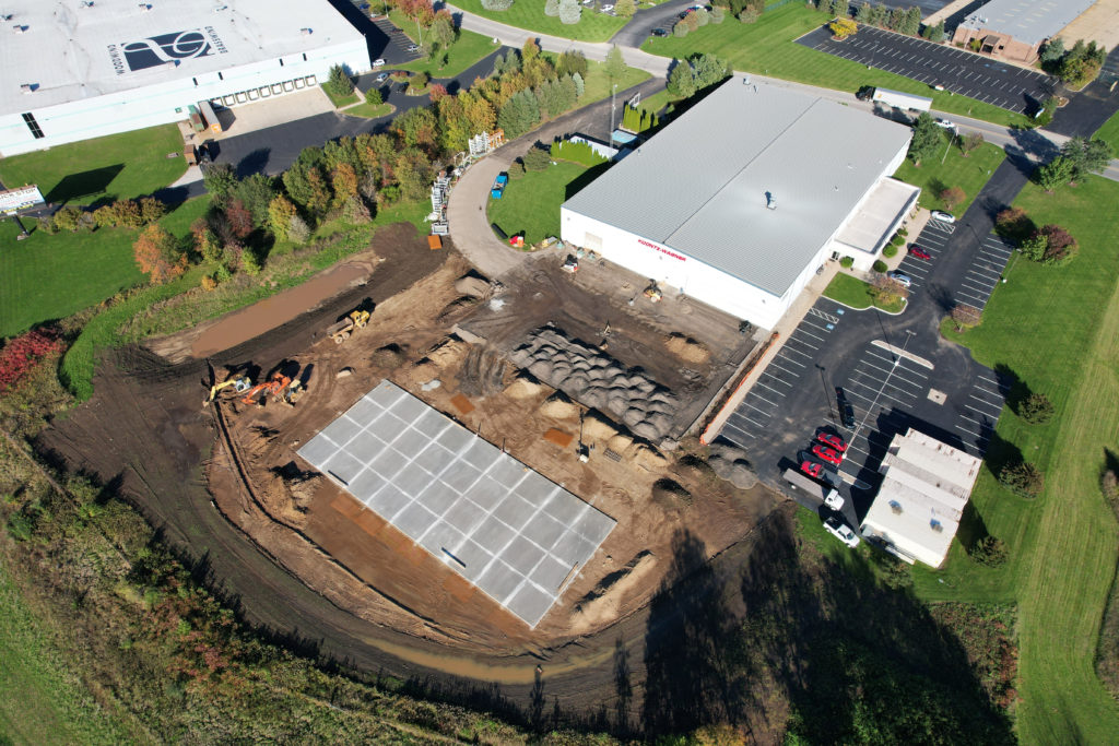
In the fast-paced world of construction, real-time data and efficient decision-making are paramount to project success. Traditional methods of project monitoring often fall short, but with the advent of aerial photography, a revolutionary transformation has taken place. Here, we delve into the numerous advantages of utilizing aerial imagery for project monitoring, demonstrating how it can elevate your construction projects to new heights.
Unparalleled Perspective
Aerial photography provides an expansive view of the project site, offering a comprehensive perspective that ground-level photographs simply cannot match. With a bird’s-eye view, you gain insights into the entire project, including intricate details that might be missed otherwise. This perspective facilitates better project oversight, enabling you to spot potential issues and make informed decisions quickly.
Real-Time Progress Tracking
Aerial photography allows you to track project progress in real-time. Regularly scheduled drone flights capture up-to-date images of the site, creating a visual timeline of the project’s evolution. This real-time tracking is invaluable for identifying delays, deviations from the plan, or areas where additional resources are needed.
Enhanced Safety
Safety is a top priority in the construction industry. Drones provide a safer alternative to human inspectors, especially in hard-to-reach or hazardous areas of the site. By reducing the need for on-site inspections, you minimize the risk to your workforce and improve overall safety measures.
Improved Communication
Aerial imagery serves as a powerful communication tool. Share high-resolution images and videos with stakeholders, including clients, investors, and team members. These visuals offer a clear and easily digestible way to convey project status, making it easier for everyone involved to stay informed and aligned.
Cost Efficiency
Efficiency leads to cost savings. Aerial photography reduces the need for extensive on-site visits, saving both time and money. By identifying potential issues early, you can address them before they escalate into costly problems.
Data-Driven Decision-Making
Aerial imagery provides a wealth of data that goes beyond visual inspection. With the right software and analysis, you can extract valuable information about site conditions, progress rates, and resource allocation. This data-driven approach enhances decision-making, allowing you to optimize project management.
Documentation and Accountability
Having a visual record of the project’s progression is essential for documentation and accountability. Aerial imagery provides an unbiased, unambiguous record of the site’s condition at various stages, helping resolve disputes and ensuring compliance with project plans.
Marketing and Reporting
Aerial imagery isn’t just for internal use. It can be a powerful tool for marketing your projects. High-quality aerial photographs and videos showcase your work in a visually stunning way, helping attract new clients and investors.
In conclusion, aerial photography is revolutionizing project monitoring in the construction industry. Its ability to provide a unique, real-time perspective, enhance safety, and drive cost savings makes it an indispensable tool for modern construction projects. By incorporating aerial imagery into your project monitoring practices, you can elevate your projects to new heights of success.
